GISTDA innovates a new trend of drought risk data service
.
Drought is a natural disaster that is caused by a lack of water for a long period of time. It is a natural disaster that affects widely for human and animal livelihood causing a lack of agricultural resources and the industrial factories have to stop operating due to a lack of water used in the process. Eventually, this created damage to the economy in this area. Today, satellite data is continuously recording geospatial data from deep space which can perceive the trend of water shortage situation in each area more accurately and provide access to information sources and understanding of the people involved, which GISTDA and its partners are currently working to accelerate to address what is considered the most important aspect of mitigation cooperation for drought.
.
The impact of drought
.
Thailand has to face drought annually, both in drought and during the rainy season which all people will get affected by a lack of water resources and agricultural products as in they cannot be sowed. The agricultural areas are most affected as the water bank cannot access all areas of the country which makes it difficult to help people in many areas.
.
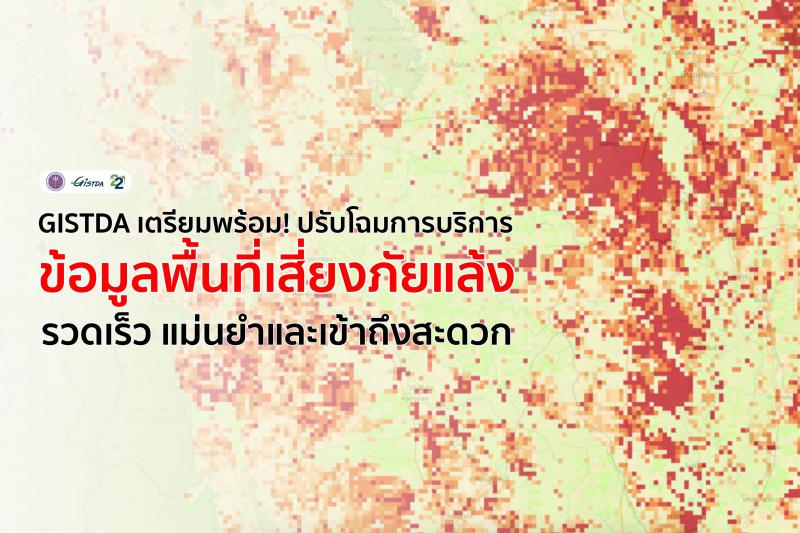
From space to drought-prone areas
Reservoir satellites rely on the principle of capturing the reflectance of radiation that hits the Earth's surface and reflects different proportions on the satellite sensor according to the context of the incident area. This allows geoscientists to extract information on the integrity of plants or trees, the humidity of the soil, the amount of water, and the temperature of the globe’s surface from satellite images. All of these data are important factors that will help us notice the tendency of drought in areas.
.
The Drought Risk Index (DRI) is a spatial dataset derived from collaborative calculations between data extracted from satellite imagery, such as the Normalized Difference Vegetation Index (NDVI), Humidity Difference Index (NDVI), and the Drought-Risk Index (DRI). (Normalized Difference Water Index : NDWI), Temperature Condition Index : TCI), The Vegetation Condition Index : VCI, Soil Moisture Index are all related factors for drought
.
The use of space technology and geospatial information to create a drought-risk area index (DRI) over the years has been continuously conducted by GISTDA to analyze data and provide services through online services. Along with the development to be better all along. This helped the agencies in solving the disaster with more spatial information about the drought situation that can be used for greater management including water management, royal rainmaking, as well as measures to help heal farmers.
.
The better development for better data
At the present, GISTDA is in its development process to create models that can assess index from satellite images with passive and active systems as well as SAR data that has a relationship with drought season as it can record data continuously without struggling with clouds when capturing images. This will be combined in index analysis to identify prone-drought areas better.
.
In addition to the index values extracted from satellite images, GISTDA also takes meteorological data and data from more than 40 ground monitoring stations that GISTDA has installed across the country to analyze together and calculate the drought index (Drought Index) that can indicate drought conditions with greater accuracy and better spatial resolution. It is something new for this development.
.
Building better access in a more convenient way
The data that comes from the analysis of drought areas will be published on the website for reference and for users to download if they want to further the analysis. Meanwhile, accessing the data through an application on a smartphone will help all people from all parts of Thailand get access faster.
.
The creation of various platforms for accessing drought-prone areas analyzed from satellite imagery will facilitate the use of information at both the policy level. operational level and area level in surveillance to prepare for drought situations and keep up with the situation
.
Delivering value from space innovation to society
The resulting benefits will enable policy-level agencies and agricultural water management units including the public sector to see the drought situation in the area is the same picture. The agencies can use the information to manage the water direction and distribution to alleviate the drought areas in a faster pace. This will help reduce damages to agricultural areas and the farmers will get support from the disaster faster too.
.
For citizens, this is a data source that helps you build an understanding of drought in each area so as to know more about preparation in the first stage to protect our agricultural areas. Coordinate with the government to provide additional information to mitigate the situation on the same basis and with the same understanding. Although this year's drought situation is mild, preparation is necessary so that in times of emergency we can still cope and prevent damage in a timely manner. Also, It is expected that the application will be completed and launched soon.
.
#GISTDAinits22ndyear #GISTDA #space #drought #naturaldisasters #watershortages #shortageofagriculture #economy #irrigation #droughtriskareasindex #relief #supportdecision